
A kayaker’s view of the Connecticut River’s run through the state: Part One
| Published: 07-14-2023 8:53 PM |
Editor’s note: This is part one of a three-part series chronicling the current state of the Connecticut River as it runs through Massachusetts, in light of the recent U.S. Supreme Court decision to limit the Clean Water Act. In part one, writer Anna Laird Barto paddles from the tri-state border to Barton Cove. Barto began her journey before this week’s catastrophic flooding throughout the region.
The water is clear enough that from my kayak I can see the wild celery rippling on the river bottom. But there’s no sign of the granite tri-state marker, which was submerged in the 1960s after the reconstruction of the Turners Falls Dam. The view is the same across state lines: steep wooded banks leading up to fields of strawberries, vegetables and hay. Rivers do not respect socially constructed boundaries.
The longest river in New England, the Connecticut starts its journey in northern New Hampshire and travels 410 miles before emptying into Long Island Sound. I start my journey at Mile 133, in Northfield. Over the next month, I’ll be paddling 68 miles across Massachusetts, through 19 towns and cities, farmland and factories.
Along the way, I’ll speak to farmers, scientists, and other stakeholders about the recent U.S. Supreme Court decision to limit the scope of the Clean Water Act, and what it means for the health of the Connecticut River watershed and those of us who call it home.
Growing up in the 1980s, I wasn’t allowed to swim in the Connecticut. The water was murky and often stank of sewage. Like many American rivers, 400 years of European colonization, agriculture and industry had turned the Connecticut — a corruption of the Pequot word Quintucket, for “Great Tidal River” — into what actress Katherine Hepburn famously called America’s “most beautifully landscaped cesspool.”
“The (river’s) health has improved dramatically since the 1970s,” said Kelsey Wentling, Massachusetts River Steward for the Connecticut River Conservancy (CRC), a Greenfield-based nonprofit whose mission is to protect and advocate for the health of the watershed and its communities. Wentling credits the turnaround largely to the 1972 federal Clean Water Act. The law prohibits discharge of chemicals, sewage and other contaminants into waters of the United States without a permit, including wetlands and seasonal water bodies.
“There were some early environmental laws before the Clean Water Act, so it was improving,” Wentling said. “But that was really the big piece of legislation that did it.”
Article continues after...
Yesterday's Most Read Articles
 Homeless camp in Northampton ordered to disperse
 The Iron Horse rides again: The storied Northampton club will reopen at last, May 15
 Final pick for Amherst regional superintendent, from Virgin Islands, aims to ‘lead with love’
 Authorities ID victim in Greenfield slaying
 Reyes takes helm of UMass flagship amid pro-Palestinian protests
 Police report details grisly crime scene in Greenfield
But on May 25, the U.S. Supreme Court ruled in favor of Michael and ChantellSackett, who the EPA blocked from filling in wetlands on their property near Priest Lake, Idaho. The decision in Sackett v. EPA states that the Clean Water Act applies only to those waters of the United States that share a “continuous surface connection” with traditional waterways like rivers, lakes and streams. This ruling could strip protections from up to 51% of wetlands in the U.S, according to the EPA and Army Corps of Engineers.
Even seasonal wetlands support the ecosystem in myriad ways, including filtering contaminants, replenishing groundwater, and providing a buffer against flooding.
“Those functions of wetlands and the values that they provide have been well recognized,” said Scott Jackson, extension professor in the Department of Environmental Conservation at the University of Massachusetts Amherst. “It’s the water and the connection with water that’s important, not whether it’s surface water or groundwater. It’s all part of the single hydrologic system.”
What does the ruling mean for our Connecticut River watershed? What does it mean for Massachusetts, a state that already has some of the most robust wetland protections in the nation? I’ll attempt to answer these questions as I make my way downstream.
It’s a sweltering Memorial Day weekend. I hug the shore to avoid speeding jet skies and motorboats. Slipping past the dock at the Riverview Picnic Area, it’s easy to overlook the string of orange buoys marking the entrance to the Northfield Mountain Pump Storage Project, operated by FirstLight Power. In 2010, the EPA shut down the facility for six months after it was discovered that FirstLight dumped truckloads of sludge into the Connecticut.
Nothing in the Sackett decision would prevent the EPA from taking action in a case like this, where the violation clearly applies to a major, navigable waterway. Unfortunately, many water quality issues originate far upstream, where the boundary between land and water is less defined.
Wentling said that toxic discharge is just one area of concern when it comes to Northfield Mountain and its downstream sister facility, the Turners Falls Dam. Just a few hundred feet from the picnic area, water is sucked uphill through a 2,500-foot tunnel into a 300-acre reservoir under Northfield Mountain. When demand for electricity is high, the plant releases thousands of gallons of water through turbines back into the river. The fluctuating water levels wreak havoc on aquatic ecosystems, recreation and irrigation, issues I’ll explore in more depth in the coming weeks.
A sluggish current carries me under the 139-foot steel arch of the French King Bridge, which cantilevers above the gorge at the confluence of the Millers River. After heavy rains, combined sewage overflow from the Millers branch can make swimming here unsafe, but today it looks like a scene from a Norman Rockwell painting; bathers sun themselves on the rocks and children jump from the miniature truss bridge at the mouth of the tributary.
I follow the river as it bends sharply to the west. Here I encounter my first wetlands, surprising a swan nesting among the tall grasses near the riverbank. A bald eagle surveys the scene from a dead tree branch. Another Connecticut River comeback story, bald eagles are again a common sight in the Valley, after going all but extinct in the mid-20th century due to DDT poisoning.
I keep a respectful distance from the swans and Canada geese and who patrol this peaceful outflow above the Turners Falls Dam, downy offspring in tow.
The first dam was built here in 1798, over what was once the largest natural waterfall in New England. Every spring, Native Americans traveled for hundreds of miles to harvest salmon and shad that spawned below the Great Falls. Today, a fish ladder assists with migration, although the minimum water flow required for their passage continues to be a sticking point in FirstLight’s negotiations for relicensing with the Federal Energy Regulatory Commission.
The last time I paddled here, in October, the water level was so low that I had to get out and drag my kayak.
The dam was raised to its current height in 1970, as part of the Northfield Mountain Pump Storage Project. The past three winters, malfunctioning equipment alarmed residents by leaking oil into the river.
In March 2023, FirstLight issued a public statement saying in part, “We are committed to implementing a permanent solution to ensure these conditions do not recur. We are taking immediate action to undertake that work as soon as we can.”
Wentling and her colleagues at the the River Conservancy are closely monitoring the situation. “I’m starting to track myself to see what the company has had to do or is going to have to do to mitigate,” she said. “And make sure this doesn’t happen again next winter.”
It’s hard to believe that this idyllic spot, surrounded by a playground, pollinator gardens, and modest residential homes, was the scene of one of the worst atrocities in Colonial American history. In 1676, an English militia led by William Turner attacked a Native village on the north bank, murdering over 300 women, children and elders. The village named for Turner is still grappling with this legacy. Town leaders are working with tribal members to honor what was lost and build a more harmonious future.
Like the events of the past, events upstream have far-reaching consequences.
Next week, I’ll continue my journey below the dam, through the agricultural heartland of Massachusetts, where our farmers and food systems rely on the health of the river.
Originally from Amherst, Anna Laird Barto lived everywhere from Wisconsin to Mexico before returning to the Valley. She currently lives in Montague and works as a freelance writer and a family support worker at a local nonprofit. She holds an MFA from Emerson College in Boston and has published fiction and nonfiction in various publications including YES! Magazine, Explore, Fodor's Travel, Hobart and Wanderlust Journal. Visit her at annalairdbarto.com or @annalairdbarto.
]]>
 Federal probe targets UMass response to anti-Arab incidents
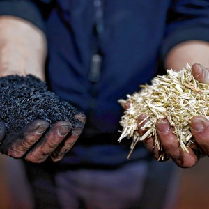 Locking up carbon for good: Easthampton inventor’s CO2 removal system turns biomass into biochar
 William Strickland, a longtime civil rights activist, scholar and friend of Malcolm X, has died