Peters World Maps transfer the 3D globe to a flat surface
| Published: 04-24-2017 4:00 AM |
AMHERST — Classrooms in Boston’s public schools will soon be using world maps that show land masses of correct size, supplementing what school officials view as traditional, Eurocentric centuries-old maps that depict Africa and Greenland as equals, even though Africa is actually 14 times as large, and center the maps on the United States and Europe.
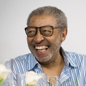
Bob Abramms, the owner of ODT, the exclusive publisher and distributor in North America of what are known as the Peters Projection maps, said he appreciates the decision by school administrators is getting international attention for what cartographers call equal-area world maps, which will be displayed side by side with the more conventional maps.
“For some reason, it’s generating quite a bit of controversy,” said Abramms, speaking by phone from his winter home in Santa Cruz, Guatemala
Abramms said the downtown Amherst office from which the maps are shipped, overseen by Ann Hopkins and Howard Bronstein, has seen a surge of interest as others are seek to join what Peters map proponents say is a new way to see the world, and to alter preconceived notions.
“Ann and Howard have been pretty busy,” Abramms said, noting that 600 of the full-size maps, measuring 39 ½-by-50 inches, have been delivered to the administration building for Boston public schools. Some smaller school districts, such as Needham, are following suit.
Developed by German historian Arno Peters in 1974, the map uses mathematical calculations to transfer the three-dimensional globe to a flat surface.
But it got pushback from some members of the cartographic community, who were concerned it was a replacement of the Mercator Projection map developed in the 16th century to help European navigators sail for the New World.
“If size is the most important thing, it’s easily the most accurate,” Abramms said of the Peters map.
Article continues after...
Yesterday's Most Read Articles
All maps of the world attempt to take the shape of a three-dimensional globe and flatten it, but not all attributes are transferable. Abramms said a problem with flat maps is what to do with all the extra white space.
While Boston school leaders told the Boston Globe that the Peters maps will “decolonize the curriculum” within the next three years, and decrease racism by using them in social studies classes in second, seventh and 11th grades, Abramms said the Peters maps aren’t the be all and end all.
“Our philosophy is it takes many different representations of the world to understand the world,” Abramms said.
But he acknowledges that the Peters maps can alter perceptions, as Africa and South America both appear larger, because they are, and the size of Europe shrinks.
And Abramms said the maps serve to wake up Americans, who remain among the most geographically illiterate people in the world.
“We have to really understand what the agenda is behind the image of the message being sent,” Abramms said.
Inside its office, Hopkins director of sales for ODT’s education division, responds to orders through the website and phone calls, many for the with 24-by-36 inch map that fits inside a standard size frame.
“It’s catching on,” Hopkins said. “We have orders from France and Great Britain and Scandinavia and Canada.”
“I place them in the appropriate tubes and answer the phone and provide help to people who don’t know what they want,” Hopkins said.
ODT began as a management consulting and human resources company focused on cultural diversity, but has morphed into a company focused on geography and media literacy, with maps surpassing 70 percent of business.
Former administrative assistant Diane Johns showed Abramms how such maps could be used in the training, and he then secured the rights to distribute them.
“I recognized the importance of the map as a brilliant, brilliant image to unfreeze people’s thinking of the world,” Abramms said.
The first time ODT got publicity on a similar scale to the Boston schools decision came when an episode of the television series “The West Wing” focused on whether President Bartlet should push for legislation mandating schools use the Peters maps. This led Abramms and staff to work 12- to 16-hour days just to keep up with orders.
In retrospect, Abramms said series creator Aaron Sorkin was prescient or prophetic, with the Warner Brothers studio requesting both the Peters maps and associated teaching materials.
“That broadcast transformed our business,” Abramms said, adding that he also got a lot of calls about whether there was actually a group known as Organization of Cartographers for Social Equity, which is referenced in the episode. “We’ve been an active business since that ‘West Wing’ episode aired.”
In fact, Hopkins said it still generates business. “After they replay it, we always get a flurry of orders,” Hopkins said.
Since Peters’ death, his widow and Huber Cartographers have given ODT free rein to describe the map in a broader way, Abramms said, rather than in the narrow view espoused by Peters that his map was the most accurate and could bring equality to the world.
With Bronstein and cartographer Mick Dyer, Abramms created the Hobo-Dyer Projection map, their own version of an equal-area map in which Africa and South America appear less elongated. ODT sells several other maps, including the “What’s Up South?” map that has Australia at the top, and the population maps that has countries illustrated by their population proportion — making Canada and Russia tiny and China and India.
Oxford Cartographs in the United Kingdom updates place names on the maps and the largest maps are printed in Indiana, Pennsylvania and laminated in Owings Mills, Maryland.
With the Boston schools purchasing the maps, Abramms said he will be involved in their roll out, including participating in a Skype conference call for an in-service day for educators.
What Boston schools are doing is not only benefiting business, but also making the concept of the ‘West Wing’ episode real.
“It takes what is fiction and makes it reality and cutting edge,” Abramms said.
Scott Merzbach can be reached at smerzbach@gazettenet.com.

 William Strickland, a longtime civil rights activist, scholar and friend of Malcolm X, has died
 Advancing water treatment: UMass startup Elateq Inc. wins state grant to deploy new technology
 New Realtor Association CEO looks to work collaboratively to maximize housing options
 Northampton man will go to trial on first-degree murder charge after plea agreement talks break down
