
Latest News
 Columnist Andrea Ayvazian: Standing as witness to Armenian martyrs
 South Hadley man fatally shot in attempted robbery
 Historic murals restored at Victory Theatre in Holyoke
 Guest columnist Bill Dwight: How to make sense of Northampton’s school budget dilemma
 Holyoke man gets 5 years for assault, drug charges
 Shelter money fading, but ‘not at the end of the line’
 Columnist Russ Vernon-Jones: Climate solutions tough, but can be done
 Sinkhole closes Eastman Lane in Amherst
 AT&T’s proposed cell tower extension moving forward in South Deerfield

New HCC president reflects on journey: Timmons sees his own struggles and arc in students’ paths
HOLYOKE — George Timmons knows just how much a difference a college president can make in a student’s life.As a senior at Norfolk State University, a historically black university in Virginia, Timmons faced the possibility of not being able to...

Boards balk at limiting use of Hadley Town Common
HADLEY — Significant work and time for municipal staff associated with preparing for New England Public Media’s annual Asparagus Festival is prompting Hadley officials to examine whether fees should be increased and other adjustments made to how...
Most Read
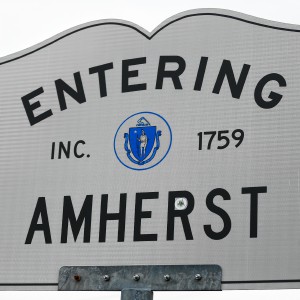
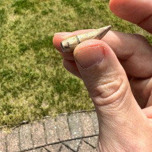
 Holyoke man finds bear paw in his yard
 Developer lands $400K loan for affordable housing project in Easthampton mill district
 Petition to block auto dealership on King Street falters in Northampton
 Fearful Belchertown residents blame stray bullets on nearby gun club, appeal to town for help
South Hadley man fatally shot in attempted robbery
Fearful Belchertown residents blame stray bullets on nearby gun club, appeal to town for help
South Hadley man fatally shot in attempted robbery
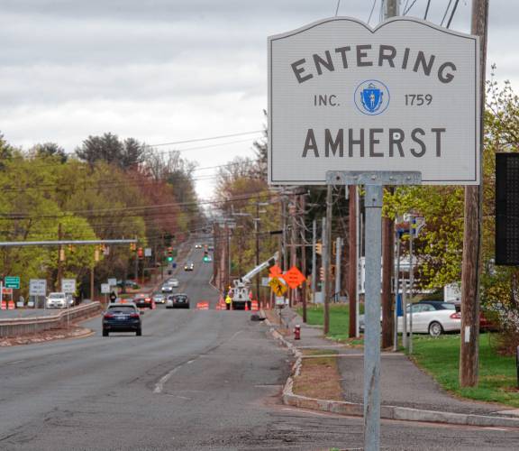
 First look at how little Amherst’s police alternative being used called troubling
Editors Picks
 A Look Back: April 20
 Painting a more complete picture: ‘Unnamed Figures’ highlights Black presence and absence in early American history
 Best Bites: A familiar feast: The Passover Seder traditions and tastes my family holds dear
 The Beat Goes On: Album release shows by Barnstar! and Lisa Bastoni, a Young@Heart Chorus concert with new special guests, and more
Sports

High schools: Ella Schaeffer sets South Hadley strikeout mark in 5-4 win over Frontier (PHOTOS)
Four runs in the sixth inning, headlined by a two-out, two-run single by Jenna Bobrowski, propelled the South Hadley softball team to a huge 5-4 independent home win over Frontier on Friday afternoon.Trailing 5-2, the Redhawks fought back to within...
 Baseball: James Lavallee tosses no-hitter as Smith Vocational blanks Mahar 7-0
 Softball: Franklin Tech’s Hannah Gilbert holds Hopkins to two hits, leads Eagles to 7-1 victory (PHOTOS)
 Southampton’s Hannah Wodecki breaks Westfield State softball’s single season RBI record
 2018 World Series trophy to be in town for Sunday’s Northampton Baseball and Softball League opening day
Opinion

Taylor Guss: Northampton's zoning should align with its climate goals
Humanity is currently facing the crisis of a generation with climate change. We exceeded 1.3 degrees Celsius of warming in 2023, just shy of 1.5 degrees, the threshold scientists warn could have catastrophic consequences for the planet. Northampton...
 Bridget Miller: Why walkability is the pathway to a healthy Amherst community
 Guest columnist Mariel E. Addis: Under seige from all sides
 Columnist Johanna Neumann: Reaping the rewards of rooftop solar
 Julia Riseman: Join Friends of Northampton Trails

Business

Petition to block auto dealership on King Street falters in Northampton
NORTHAMPTON — A joint meeting between the Northampton City Council’s Committee on Legislative Matters and the city’s Planning Board heard public comments on a petition to ban further automobile dealerships near the city’s downtown, an issue that...
 Flair and flavor: Couple draws on European, regional travel and food expertise to bring gourmet Aster + Pine Market to Amherst
 Prices up, sales down in early spring housing market
 Area property deed transfers, April 18
 Tea Guys of Whately owes $2M for breach of contract, judge rules
e-Edition
Arts & Life

Hitting the ceramic circuit: Asparagus Valley Pottery Trail turns 20 years old, April 27-28
A lot can change in 20 years: Presidents and other politicians come and go, new cultural fads and technologies emerge, clothing styles morph, and music and movies take on different dimensions.In these parts, one tradition hasn’t changed. Since 2005,...
 Valley Bounty: Your soil will thank you: As garden season gets underway, Whately farm provides ‘black gold’ to many
 Earth Matters: From Big Sits to Birdathons: Birding competitions far and near
 Speaking of Nature: Indulging in eye candy: Finally, after such a long wait, it’s beginning to look like spring is here
 Weekly Food Photo Contest: This week’s winner: Nicholas Horton of Northampton
Obituaries
 Crystal L. Bergeron
Crystal L Bergeron Easthampton, MA - Crystal L Bergeron, 39, of Easthampton sadly left us as she passed away peacefully at home on April 11th, 2024. She was born July 18, 1984, to Roger J Be... remainder of obit for Crystal L. Bergeron
 Richard A. Weber
Richard A Weber Shutesbury, MA - In the earliest hour of Saturday, April 13, 2024, surrounded by the tremendous love of his family, Richard Weber, 60, gently left this world. Rich leaves... remainder of obit for Richard A. Weber
 Daniel James Moriarty
Granby, MA - Daniel J. Moriarty, 66, passed away unexpectedly on April 14, 2024. He was born January 12, 1958 in Holyoke, MA. to the late Donald and Marie Moriary. Daniel grew up in South H... remainder of obit for Daniel James Moriarty
 Jack Glickman
Florence, MA - Jack Glickman passed away peacefully, with three of his daughters by his side, after a period of failing health on April 18th just days short of his 96th birthday. Jack was b... remainder of obit for Jack Glickman